

Explore the best hiking trails in Victoria.
When you think of Victoria of course your thoughts go straight to Melbourne, so much so that we almost forget about the rest of this amazing State and the adventures to be had outside of the city.
From the tropical Dandenong’s or the rugged coast, there’s a huge number of beautiful sites and accompanying walking trails to enjoy.
Here are the best walking trails in Victoria.
Bushrangers Bay Trail
Location: Mornington Peninsula National Park
Length: 6km
Accessible from the Boneo Road car park and picnic area, this track leads you through bushland and down to – you guessed it – Bushrangers Bay.
This beautiful coastline was named after two escaped convicts, and ticks all the boxes for a beach walk. Sandy coast, rugged cliffs, jagged rocks for the waves to smash against. Whether you want to frolic, brood or just get on with the walk this is a great track.
If you want a shorter walk, you can do the 2.6km Bushrangers Bay Track from the Cape Schanck car park.
Sugarloaf Reservoir Circuit
Location: Sugarloaf Reserve Park
Length: 15.3km
As you can tell from the name, this walk takes you around a freshwater reservoir, which remains pretty much in view throughout your whole walk.
There’s a gradual climb up to vantages that will give you views of the city in the distance – which is about 60km away – and the Yarra Valley.
The track is well maintained, but with plenty of space for nature to run wild, so while it’s a short drive from Melbourne you may as well be worlds away.
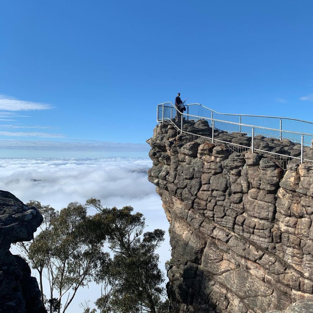
Halls Gap Pinnacle Track
Location: Grampians National Park
Length: 8.5km
If you think you’ll be walking around these precarious pinnacles you’re in for a surprise. The track actually goes over these towering stone monoliths that look out over the Grampians National Park.
While it might appear ridiculous from below, the track is actually very doable, with fencing to ensure you don’t fall down the steep ravines and plenty of different options of varying difficulties to take on.
If you don’t want to do a longer 8.5km walk, there’s a 4.2km track that takes just a couple of hours and is less of a challenge.
Whichever path you choose, walking the tracks across the pinnacles will be a day to remember.
Cape Woolamai Circuit
Location: Phillip Island National Park
Length: 8.9km
That’s right, this track is not on the mainland but instead an island off Victoria’s coast.
Before you ask, you can drive there, there’s a short bridge over to the island and altogether it’s only a two-hour drive from Melbourne.
The Cape Woolamai Circuit is a combination of three smaller walks, including the Pinnacles walk (just 4km long and not to be confused with the track at Halls Gap), the Old Granite Quarry Walk (6 kilometres) and the Cape Woolamai Beacon Walk (6.6 kilometres).
If you’re confident the circuit encompasses all three, with heaps of views over the coast with its ancient rock formations, and across rolling headlands.
Lerderderg Gorge Circuit
Location: Lederdeg State Park
Length: 8.4km
This loop trail takes you through the stunning Lerderderg gorge and isn’t for the faint-hearted.
It’s rated as difficult with a fair bit of elevation and loose rock to clamber over.
And if it’s not rocks, it’s flooding. Not the wash-you-away kind of flooding, more the oh-no-the-track-is-flooded-my-shoes-are-now-wet kind of flooding.
The circuit track is a combination of a couple of trails. Start at the main carpark, head north on the Lerderderg Gorge track and follow the river until you hit Link Track Number Two. This follows what’s called the Blackwood Ranges track, which you should stay on until you reach a fork in the road with Link Track Number one marked, on which you’ll turn left.
Then you’re heading downhill for a kilometre or so before getting back to the carpark.
Simples.
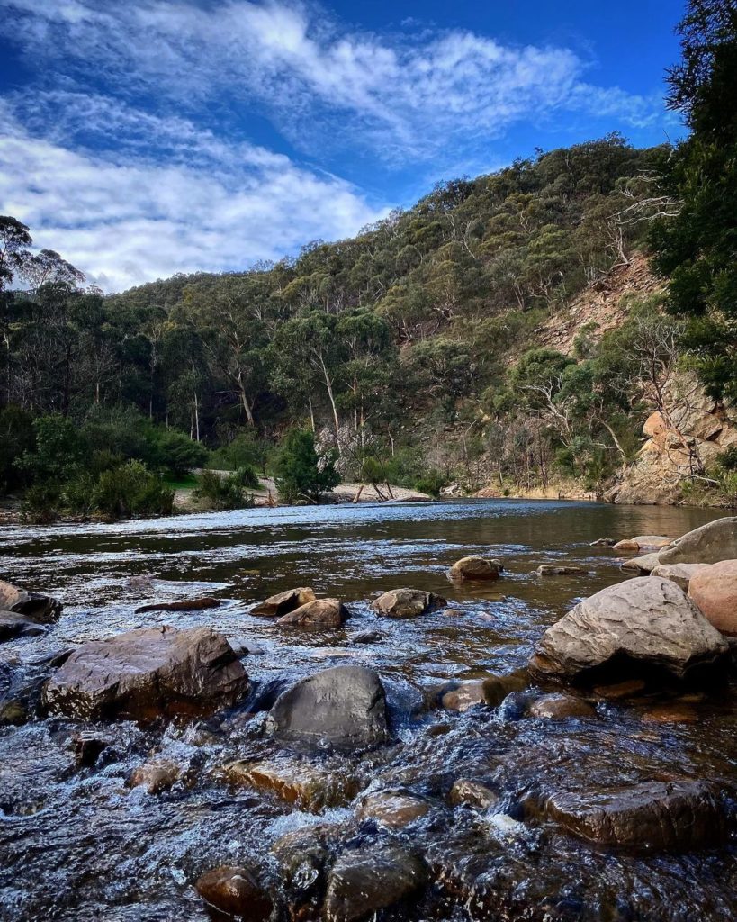
Werribee Gorge Circuit Walk
Location: Werribee Gorge State Park
Length: 7.6km
Located right near Pentland Hills, this track explores another gorge and just begs for you to take some outback snaps among this gorgeous landscape.
The hike starts at Meikles Point Picnic Area and follows a route along the Werribee River.
There are a few points where you need to scrabble over some rocks and cliff sections, but the track is overall very doable and rated as moderate.
When it’s warm enough there are heaps of freshwater spots to dive into and cool off from your walk, so bring your bathers.
Flinders Peak Walk
Location: You Yangs National Park
Length: 3.2km
While it’s not the longest trail, this trek is still challenging and mostly uphill.
As with all things though, the bigger the challenge, the bigger the reward!
That being, more views, more scenery and more calories burned off.
But seriously there are 450 steps to get up and down (900 altogether) so strap on those hiking shoes and get ready for some huffing and puffing.
By the end, you’ll have reached the highest point in You Yang National Park.
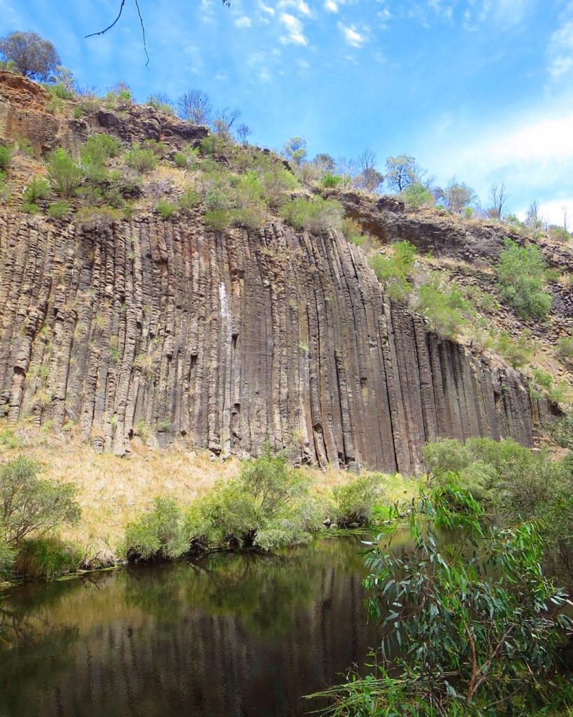
Organ Pipes National Park
Location: Organ Pipes National Park
Length: 1.5km
This short walk takes you right to one of the natural wonders of Victoria, the organ pipes.
No, not actual organ pipes, a rock formation that looks a hell of a lot like them.
To get to them, park at the top of the old volcano and walk downhill until you reach Jackson Creek.
Hanging above it are the pipes themselves. How were they formed? By molten lava running down the hillside millions of years ago and now frozen in time…of course.
Eastern Sherbrooke Forest Walk
Location: Dandenong Ranges National Park
Length: 6.6km
Get amongst the famous Dandenong Ranges and step back through what seems like millions of years.
With the tall ferns and trees around you, you’ll half expect to see a dinosaur traipsing through the forest towards you.
This particular walk will ensure you see one of the most beautiful parts of the expansive Dandenong Ranges.
The stroll is gentle but will still take you a good couple of hours as you wander amongst the wilderness.
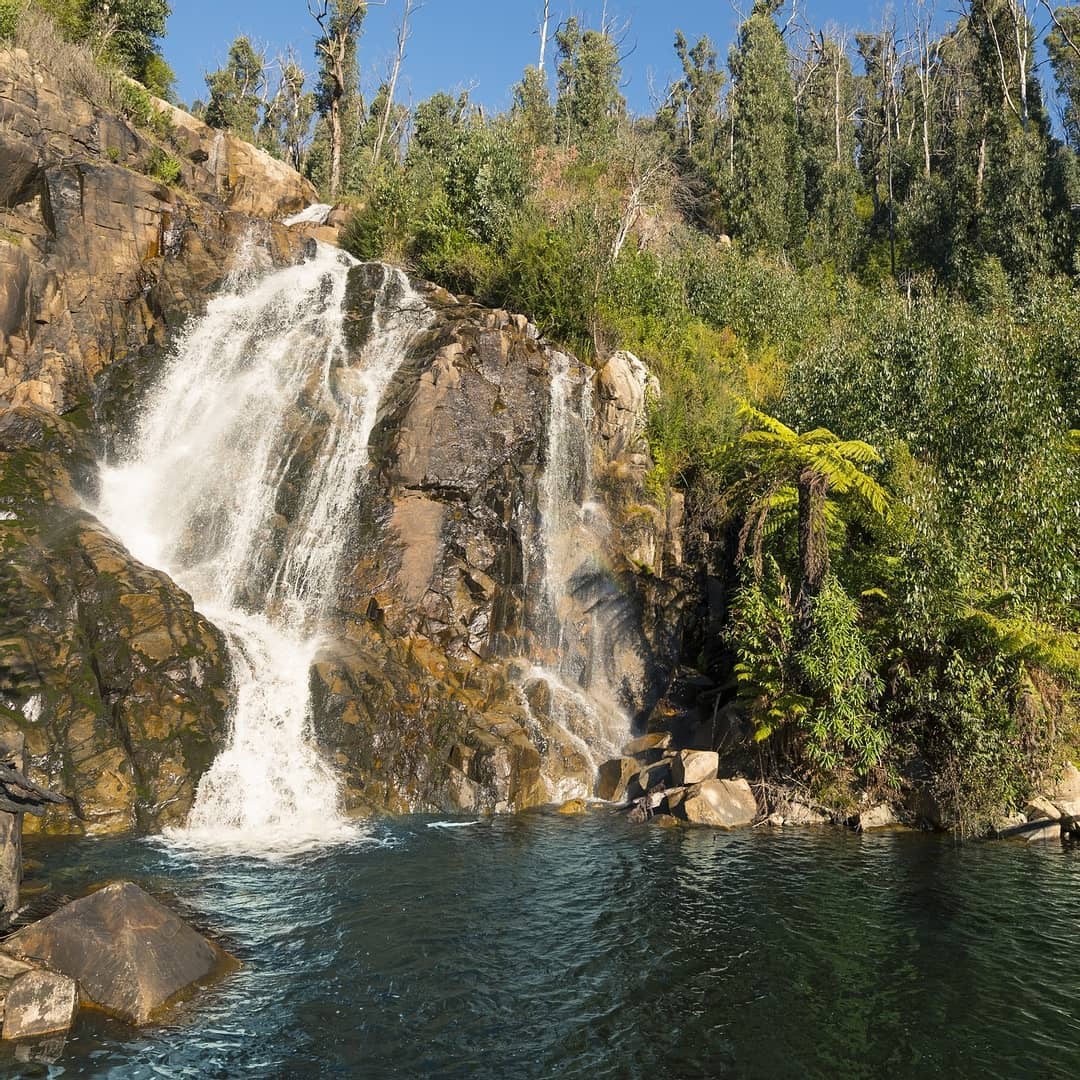
Keppel Lookout and Steavenson Falls via Tree Fern Gully Track Loop
Location: Steavenson Falls
Length: 10.3km
This track features some excellent bushwalking but also the satisfaction of a few waterfalls for you to enjoy and snap pictures of for the gram.
There’ll be other gram-worthy snaps too, like the views of the Yarra and Cathedral Ranges, which stretch out beneath you at the lookouts.
The mountain ash forest surrounding you is dense and full of wildlife, including a multitude of birds.
Getting up to Keppel Lookout is a bit steep at first, but the track overall is doable and rated as moderate.

Related Reads:
Discover more of Australia with the latest Australia travel reads on SoWhereNext.com.au.